

Hung Shek Mun
- Ami Tsz Wing Wong
- Aug 25, 2020
- 3 min read
Hung Shek Mun is well-known for its reddish rocky bay, it is at the north-eastern end in the New Territories, even further from Tai Po. Its redness is due to prolonged period of oxidation of the iron in rocks by oxygen in air. Since this place is inconvenient to travel to, less people have been here, water in the bay has been conserved in high quality, blue and clear. I hope even with more people knowing this great spot of attraction, the surroundings and the water can still have their qualities maintained, by visitors being responsible: Take your rubbish with you and trash them back when you are back to the urban zones!


We started from Wu Kau Tang Bus Terminal, walked on a downhill slope next to a pavilion and turned left at the road junction. We followed the concrete road and walked for around 5 minutes, road turned to a sandy path.
After bypassing a red urgent telephone booth(on the left hand side), we walked along the right muddy path and entered Miu Sam Ancient Trail, which would passed via Sheung Miu Tin and Ha Miu Tin. Then, we had to cross a stream and afterwards, turned right where we could see an inclining slope, which appeared to be never ending, with massive rocks.
*It is advised to take rest whenever one finds any area with shades and when there are any breezes.Due to 100% exposure to the sun, it would be ideal to stay hydrated and snack frequently so as to maintain a stable level of glucose level, water and energy in the bodies.


We began to walk along the Plover Cove Reservoir Country Trail after more than 250m of continuous inclination. Both Tai Tung and Mount Newland would be passed, before reaching Hung Shek Mun Au. There was actually no sign for Hung Shek Mun Au, we recognized it by a warning sign on the right hand side of the road, stating: 'DANGER Steep Cliff Ahead, No Access Beyond this Point'; and a numerous colorful ribbons on the left had side of the road, below which hid a tiny bushy path.
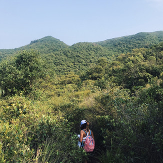
We had to walk into these bushes for around an hour and half, to descend ourselves until our destination. It was highly recommended to wear long sleeves tee and long sport-pants as there were thorns, large spider nets, so to prevent one from being wounded. Right before we arrived our destinations, we would have to walk by a pond and an abandoned house.
*To leave Hung Shek Mun, there are a couple of ways: either return the same way we come, that was what we did; or walk along the rocky bay until the opposite end where Wu Chau Tong is, then walk in the direction of Dit Sei Kau and Cheng Pai Tun, cross the Northern Subsidiary Dam to Pak Sha Tau, then cross the Main Dam which eventually leads us back to Tai Mei Duk. The former is approximately 5km shorter than the latter.


Wu Kau Tang is the beginning of our hike, which is far away from Tai Po Market Train Station. There are several ways to get there:
Take minibus no. 20R from Tai Po Market Bus Terminal outside exit A2. They are as scheduled and with much less frequency than those in the urban areas. Hence, it would be best to have a hiking plan ahead.
Take taxi/ Uber at around HKD$104 for single way.


Comments